The 2025 Atlantic hurricane season has officially delivered its first major test with Hurricane Erin, a powerful system now moving steadily toward the U.S. coastline. Classified as the season’s first significant hurricane, Erin is already stirring concern among meteorologists, emergency planners, and coastal residents. Forecast models show the storm carrying sustained winds strong enough to cause widespread damage, with the added threats of torrential rainfall and storm surges capable of inundating low-lying areas.
As Erin approaches, state and local governments are urging residents not to wait until the last minute to prepare. Shelters are being readied, emergency crews are on standby, and evacuation orders may soon follow depending on Erin’s trajectory. For millions living along the vulnerable stretch of coastline, Hurricane Erin is a sobering reminder that hurricane season is not just a date on the calendar—it is a living reality that demands vigilance.

The Formation and Growth of Hurricane Erin
Hurricane Erin’s journey began as a cluster of thunderstorms over the warm waters of the central Atlantic earlier this month. Favorable conditions—including sea surface temperatures well above average and low wind shear—allowed the system to strengthen rapidly. What started as a tropical depression soon intensified into a tropical storm, and within 48 hours, it reached hurricane status.
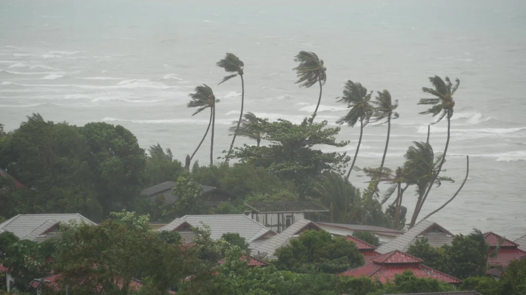
Meteorologists note that Erin’s development underscores the dangers of rapid intensification, a trend that has become more common in recent hurricane seasons. With ocean waters acting as fuel, the storm gained strength faster than initially expected, catching the attention of forecasters and emergency officials alike. Current satellite imagery shows a well-defined eye and expansive storm bands stretching hundreds of miles, suggesting that Erin could impact a broad swath of coastline even if it does not make a direct landfall.
Potential Impacts on Coastal Communities
Communities along the projected path of Hurricane Erin are bracing for a range of potential impacts. Sustained winds at hurricane-force speeds can damage homes, uproot trees, and disrupt power for days or even weeks. Heavy rainfall increases the likelihood of flash flooding, particularly in urban areas where drainage systems may be overwhelmed.
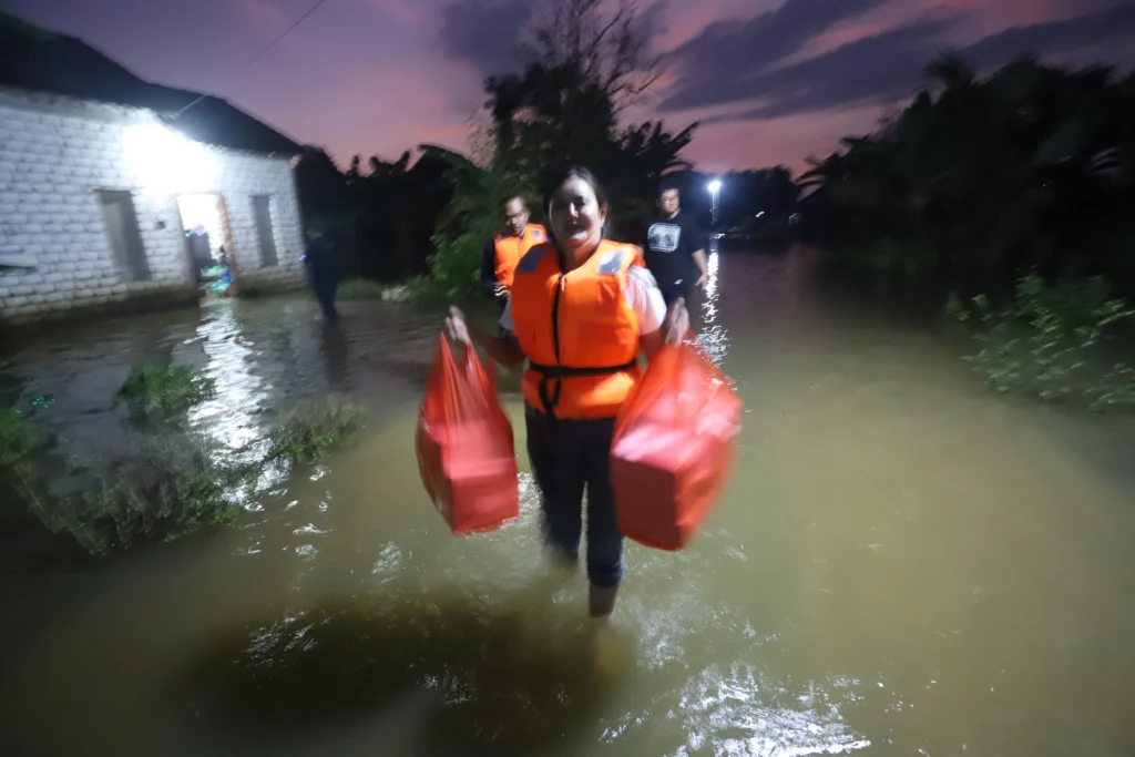
Perhaps the most dangerous threat comes from storm surge—the abnormal rise of seawater pushed inland by the hurricane’s winds. Even a moderate surge can inundate neighborhoods, destroy infrastructure, and render roads impassable. Low-lying towns, barrier islands, and estuaries are especially vulnerable. Emergency managers have warned that residents should not underestimate this risk, as storm surge historically accounts for a large portion of hurricane-related fatalities.
In addition, coastal economies dependent on tourism and fishing face uncertainty. Beaches are being closed, ports are preparing for shutdowns, and businesses are rushing to safeguard property. For many small communities, even a temporary disruption could have lasting financial effects.
Preparedness Measures and Safety Tips
With Hurricane Erin serving as a wake-up call, authorities are stressing the importance of personal and community preparedness. Officials urge residents to:
- Assemble emergency kits that include food, water, flashlights, batteries, medications, and important documents.
- Secure property by boarding up windows, clearing yards of loose debris, and reinforcing doors.
- Plan evacuation routes in advance and have a designated meeting place for family members.
- Stay informed by monitoring updates from the National Hurricane Center, local news, and weather alerts.
- Avoid complacency—even if Erin weakens slightly before landfall, tropical systems can still produce deadly flooding and dangerous winds.
Local governments are also taking proactive steps. National Guard units are on alert, power companies are preparing to deploy repair crews, and hospitals are activating emergency protocols. In coastal cities, sandbag stations are being set up, and first responders are checking equipment and rescue boats.

Looking Ahead: The Season’s Outlook
While Hurricane Erin dominates headlines now, meteorologists caution that it may only be the beginning of a long and potentially active season. Climate scientists point to unusually warm Atlantic waters and favorable atmospheric conditions that could give rise to more frequent and stronger storms. Some seasonal outlooks have already predicted above-average hurricane activity this year, raising concerns about the cumulative toll on vulnerable communities.
For now, all eyes remain on Erin. Whether it makes a direct landfall or skirts along the coast, its size and intensity mean impacts are almost guaranteed. The unfolding situation is a stark reminder that coastal living comes with risks that require constant awareness and preparation.
As the season progresses, residents are urged not only to respond to Hurricane Erin but also to use this moment as a call to action—reviewing emergency plans, reinforcing homes, and fostering a culture of readiness. The first storm of the season often sets the tone, and Hurricane Erin is already proving that preparation can make the difference between safety and disaster.
Table of Contents
Cloudflare Warns: AI Threatens the Web Economy – trendsfocus